Mount Batur Caldera, Bali
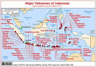
 Batur caldera is situated in the north eastern part of Bali Island, and about 70 km north of the capital city of Denpasar. There are six main routes of travel to the caldera that can be attained from Denpasar and one route from Singaraja. The most useable of these is the road from Denpasar to Kintamani passing Bangli city.
Batur caldera is one of the finest calderas in the world, about 13.8 by 10 kilometers ( Van Bemmelen, 1949) with another circular composite collapse structure with a diameter of 7.5 km formed in its center. The rim varies in height from 1267 to 2152 meters (the marginal cone of Mount Agung ). Within caldera is the active strato volcano of Batur volcano and a lake. The highest peak of Batur volcano is about 1717 m above sea level and 686 m above the surface of lake Batur, and is located at 8°14’ 30’’ S and 115°22’30’’ E ( van Padang, 1951 ; Kusumadinata,1979 ).
Batur caldera is situated in the north eastern part of Bali Island, and about 70 km north of the capital city of Denpasar. There are six main routes of travel to the caldera that can be attained from Denpasar and one route from Singaraja. The most useable of these is the road from Denpasar to Kintamani passing Bangli city.
Batur caldera is one of the finest calderas in the world, about 13.8 by 10 kilometers ( Van Bemmelen, 1949) with another circular composite collapse structure with a diameter of 7.5 km formed in its center. The rim varies in height from 1267 to 2152 meters (the marginal cone of Mount Agung ). Within caldera is the active strato volcano of Batur volcano and a lake. The highest peak of Batur volcano is about 1717 m above sea level and 686 m above the surface of lake Batur, and is located at 8°14’ 30’’ S and 115°22’30’’ E ( van Padang, 1951 ; Kusumadinata,1979 ).

Tidak ada komentar:
Posting Komentar